
1969 Map of Boise City SW
USGS Topo · Published 1971About this map
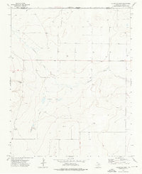
The North Canadian River winds through the northern portion of this High Plains landscape, which was documented by the Oklahoma Geological Survey and federal agencies during the late 1960s. The terrain is defined by broad sections such as Wheeless, Gresham, and Cleveland, reflecting the organized township and range grid that dictated settlement in the Panhandle. Near the center of the sheet, the Bertrand Cem serves as a vital marker for genealogists, located just north of where Aqua Fria Creek cuts across the lower half of the quadrangle. The map captures an era of low-density ranching and resource extraction, evidenced by several water wells and a small Gravel Pit near the river. This survey follows the state line, showing the precise boundary where Cimarron Co meets the Texas border.
Find a feature on this map
10 named features on this map. Tap any name to fly to it.
Don’t see what you’re looking for? This feature index may not catch every label — zoom into the map to look around manually.
Map Details
Editions of this 1969 Boise City SW Map
This is the sole edition of this map. No revisions or reprints were ever made.
Other maps of this area

1954 · Dalhart
USGS Topo · 1:250,000

1958 · Dalhart
USGS Topo · 1:250,000

1962 · Dalhart
USGS Topo · 1:250,000

1969 · Boise City
USGS Topo · 1:24,000

1969 · Boise City NW
USGS Topo · 1:24,000

1969 · Felt
USGS Topo · 1:24,000

1969 · Boise City SE
USGS Topo · 1:24,000

1969 · Felt NE
USGS Topo · 1:24,000

1973 · Buffalo Springs
USGS Topo · 1:24,000
1973 · Coldwater West
USGS Topo · 1:24,000