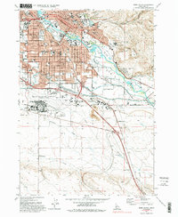
1972 Map of Boise South
USGS Topo · Published 1994About this map
The State Capitol and the civic heart of Idaho's capital city are detailed in this early 1970s survey. This map captures Boise during a period of significant mid-century growth, showcasing the development surrounding Boise State College and the expanding residential corridors along Vista Ave and Overland Road. The urban core is balanced by extensive public spaces like Ann Morrison Park and Julia Davis Park, while the city's older history is preserved at the Pioneer Cem and the Old Military Reservation Boundary.
Find a feature on this map
91 named features on this map. Tap any name to fly to it.
Don’t see what you’re looking for? This feature index may not catch every label — zoom into the map to look around manually.
Map Details
Editions of this 1972 Boise South Map
4 editions found
Other maps of this area

1892 · Boise
USGS Topo · 1:125,000

1892 · Bisuka
USGS Topo · 1:125,000

1894 · Bisuka
USGS Topo · 1:125,000

1897 · Boise
USGS Topo · 1:125,000

1949 · Robie Creek
USGS Topo · 1:24,000

1953 · Eagle
USGS Topo · 1:24,000

1953 · Cloverdale
USGS Topo · 1:24,000

1954 · Boise South
USGS Topo · 1:24,000

1954 · Boise North
USGS Topo · 1:24,000

1954 · Boise
USGS Topo · 1:62,500