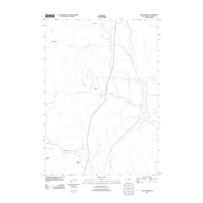
2012 Map of Boland Ridge
USGS Topo · Published 2012About this map
Unkpapa Peak and the high elevation of Boland Ridge dominate this section of Custer County, where the southern Black Hills transition into the surrounding plains. The landscape is defined by deep cuts like Fuson Canyon and Calico Canyon, which channel drainage from the higher ridges toward the flatlands. This drainage network is anchored by several watercourses including Blacktail Cr and Lame Johnny Cr, which flow through an area with sparse modern infrastructure.
Find a feature on this map
14 named features on this map. Tap any name to fly to it.
Don’t see what you’re looking for? This feature index may not catch every label — zoom into the map to look around manually.
Map Details
Editions of this 2012 Boland Ridge Map
This is the sole edition of this map. No revisions or reprints were ever made.
Other maps of this area

1894 · Hermosa
USGS Topo · 1:125,000

1896 · Oelrichs
USGS Topo · 1:125,000

1900 · Oelrichs
USGS Topo · 1:125,000

1901 · Hermosa
USGS Topo · 1:125,000

1950 · Hot Springs
USGS Topo · 1:24,000

1950 · Buffalo Gap
USGS Topo · 1:24,000

1951 · Smithwick NW
USGS Topo · 1:24,000

1955 · Mt. Coolidge
USGS Topo · 1:24,000

1955 · Hot Springs
USGS Topo · 1:250,000
1957 · Wind Cave
USGS Topo · 1:24,000