
2015 Map of Boland Ridge
USGS Topo · Published 2015About this map
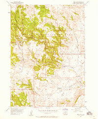
Wind Cave National Park dominates the northwestern portion of this terrain, where the high elevations of Boland Ridge overlook a complex network of drainages. The landscape is defined by its dramatic geological transitions, featuring prominent landmarks like Unkpapa Peak and the deep cuts of Fuson Canyon and Calico Canyon. These natural corridors have long influenced movement through the Black Hills region, as seen in the placement of Buffalo Gap in the southwest. A web of watercourses, including Lame Johnny Cr, Cottonwood Cr, and Beaver Cr, dissects the area, providing the primary geographic framework for early roads such as Lame Johnny Rd and Beaver Valley Rd. The survey illustrates the intersection of protected federal land and the rugged township and range sections of Custer County.
Find a feature on this map
20 named features on this map. Tap any name to fly to it.
Don’t see what you’re looking for? This feature index may not catch every label — zoom into the map to look around manually.
Map Details
Editions of this 2015 Boland Ridge Map
This is the sole edition of this map. No revisions or reprints were ever made.
Other maps of this area

1894 · Hermosa
USGS Topo · 1:125,000

1896 · Oelrichs
USGS Topo · 1:125,000

1900 · Oelrichs
USGS Topo · 1:125,000

1901 · Hermosa
USGS Topo · 1:125,000

1950 · Hot Springs
USGS Topo · 1:24,000

1950 · Buffalo Gap
USGS Topo · 1:24,000

1951 · Smithwick NW
USGS Topo · 1:24,000

1955 · Mt. Coolidge
USGS Topo · 1:24,000

1955 · Hot Springs
USGS Topo · 1:250,000
1957 · Wind Cave
USGS Topo · 1:24,000