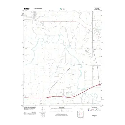
2009 Map of Boley
USGS Topo · Published 2009About this map
The North Canadian River carves a serpentine path through this section of Okfuskee County, anchoring a landscape defined by its petroleum history and rural settlements. To the northwest, the town of Boley sits atop a grid of streets including Leftwich St and E 1050 Rd, while the village of Castle occupies the eastern edge near Klutts Lake. The region's industrial character is clear from the numerous active areas like the East Boley Oil Field and Dill Oil Field, reflecting the long-standing importance of the energy sector to the local economy. Genealogists will find several burial grounds preserved across the townships, including West Cemetery, Castle Cemetery, and Rusk Cemetery. Water management is prominent through several dams such as Oknoname 107006 Dam, which regulate the tributaries feeding into Sand Creek and Walnut Creek.
Find a feature on this map
38 named features on this map. Tap any name to fly to it.
Don’t see what you’re looking for? This feature index may not catch every label — zoom into the map to look around manually.
Map Details
Editions of this 2009 Boley Map
This is the sole edition of this map. No revisions or reprints were ever made.
Other maps of this area

1896 · Seminole and Prague
USGS Topo · 1:125,000

1900 · Wewoka
USGS Topo · 1:125,000

1901 · Nuyaka
USGS Topo · 1:125,000

1929 · Stroud
USGS Topo · 1:62,500

1932 · Stroud
USGS Topo · 1:62,500

1954 · Oklahoma City
USGS Topo · 1:250,000

1957 · Oklahoma City
USGS Topo · 1:250,000

1963 · Oklahoma City
USGS Topo · 1:250,000

1967 · Cromwell
USGS Topo · 1:24,000

1967 · Prague NE
USGS Topo · 1:24,000