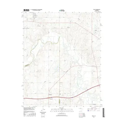
2016 Map of Boley
USGS Topo · Published 2016About this map
The North Canadian River meanders across this central Oklahoma landscape, defining the borderlands between Okfuskee and Seminole counties. This mid-2010s survey reveals a dense concentration of rural burial grounds, including Boley Cem, East Saint Emmanuel Cem, Rusk Cem, and Schoolton Cem, reflecting the area's deep-rooted family history and diverse settlement patterns. The map highlights several small rural hubs such as Cromwell, Schoolton, and Castle, many connected by a systematic grid of county roads like e1050 RD and n3680 RD. In the north, the street layout near the Boley vicinity includes named thoroughfares such as Lincoln Ave and Georgia Ave. The drainage of the river is supported by local tributaries including Buckeye Cr, Walnut Cr, and Sand Cr, which flow through the rolling terrain toward Klutts Lake.
Find a feature on this map
54 named features on this map. Tap any name to fly to it.
Don’t see what you’re looking for? This feature index may not catch every label — zoom into the map to look around manually.
Map Details
Editions of this 2016 Boley Map
This is the sole edition of this map. No revisions or reprints were ever made.
Other maps of this area

1896 · Seminole and Prague
USGS Topo · 1:125,000

1900 · Wewoka
USGS Topo · 1:125,000

1901 · Nuyaka
USGS Topo · 1:125,000

1929 · Stroud
USGS Topo · 1:62,500

1932 · Stroud
USGS Topo · 1:62,500

1954 · Oklahoma City
USGS Topo · 1:250,000

1957 · Oklahoma City
USGS Topo · 1:250,000

1963 · Oklahoma City
USGS Topo · 1:250,000

1967 · Cromwell
USGS Topo · 1:24,000

1967 · Prague NE
USGS Topo · 1:24,000