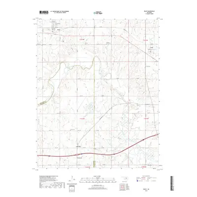
2018 Map of Boley
USGS Topo · Published 2018About this map
Boley sits in the northern reaches of this Okfuskee County landscape, anchored by a historic grid of streets including Georgia Ave and Seward Ave. The terrain is defined by the winding course of the North Canadian River, which meanders through the central and southern portions of the quadrangle, creating a complex series of oxbows and wetlands. This waterway historically shaped the development of surrounding small communities like Schoolton and Cromwell, where the road network follows the section lines of the Public Land Survey System.
Find a feature on this map
42 named features on this map. Tap any name to fly to it.
Don’t see what you’re looking for? This feature index may not catch every label — zoom into the map to look around manually.
Map Details
Editions of this 2018 Boley Map
This is the sole edition of this map. No revisions or reprints were ever made.
Other maps of this area

1896 · Seminole and Prague
USGS Topo · 1:125,000

1900 · Wewoka
USGS Topo · 1:125,000

1901 · Nuyaka
USGS Topo · 1:125,000

1929 · Stroud
USGS Topo · 1:62,500

1932 · Stroud
USGS Topo · 1:62,500

1954 · Oklahoma City
USGS Topo · 1:250,000

1957 · Oklahoma City
USGS Topo · 1:250,000

1963 · Oklahoma City
USGS Topo · 1:250,000

1967 · Cromwell
USGS Topo · 1:24,000

1967 · Prague NE
USGS Topo · 1:24,000