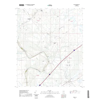
2018 Map of Boligee
USGS Topo · Published 2018About this map
The Tennessee-Tombigbee Waterway defines the western edge of this Greene County landscape, where the river's winding path creates a series of named points and crossings like Swilleys Bend and Trussel Shoals. The interior transition from the wetlands of Cypress Swamp to the higher ground of Solomon Hill is marked by numerous family-named cemeteries, suggesting a deep genealogical record in settlements such as Mount Hebron and Boligee. The map traces the river's historical importance through features like Howards Bar and Clays Bluff, while the inland area is connected by a network of rural roads such as Pannel Dewman Hwy. The presence of the Boligee Canal and local drainage features like Meeting House Br reveal a landscape long managed for its proximity to the Tombigbee's floodplain.
Find a feature on this map
84 named features on this map. Tap any name to fly to it.
Don’t see what you’re looking for? This feature index may not catch every label — zoom into the map to look around manually.
Map Details
Editions of this 2018 Boligee Map
This is the sole edition of this map. No revisions or reprints were ever made.
Other maps of this area

1927 · Eutaw
USGS Topo · 1:48,000

1929 · Epes
USGS Topo · 1:48,000

1931 · Eutaw
USGS Topo · 1:62,500

1932 · Epes
USGS Topo · 1:62,500

1947 · Forkland
USGS Topo · 1:24,000

1949 · Forkland
USGS Topo · 1:24,000

1953 · Montgomery
USGS Topo · 1:250,000

1953 · Meridian
USGS Topo · 1:250,000

1956 · Montgomery
USGS Topo · 1:250,000

1957 · Meridian
USGS Topo · 1:250,000