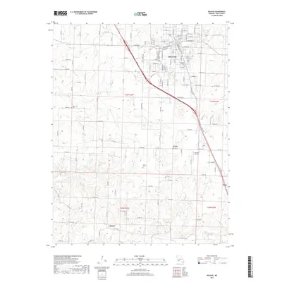
2017 Map of Bolivar
USGS Topo · Published 2017About this map
Bolivar serves as the regional hub for Polk County, anchored by the campus of Southwest Baptist Univ and a grid of streets including W Broadway St and E Division St. This 2017 survey details the urban center's expansion alongside rural landscapes marked by several family and municipal burial grounds, such as City Cem, Greenwood Cem, and Spencer Cem to the west. The terrain is defined by a dendritic network of waterways, including Bear Cr, Walnut Cr, and Tommie Cr, which carve through the land surrounding smaller outlying communities. To the south and east, the settlements of Karlin, Wishart, and Slagle remain distinct locales connected by a web of county roads and the Cherokee Airpark, illustrating the modern balance of collegiate life and Missouri's enduring agricultural character.
Find a feature on this map
112 named features on this map. Tap any name to fly to it.
Don’t see what you’re looking for? This feature index may not catch every label — zoom into the map to look around manually.
Map Details
Editions of this 2017 Bolivar Map
This is the sole edition of this map. No revisions or reprints were ever made.
Other maps of this area

1884 · Springfield
USGS Topo · 1:125,000

1884 · Bolivar
USGS Topo · 1:125,000

1886 · Stockton
USGS Topo · 1:125,000

1886 · Greenfield
USGS Topo · 1:125,000

1886 · Springfield
USGS Topo · 1:125,000

1888 · Greenfield
USGS Topo · 1:125,000

1892 · Bolivar
USGS Topo · 1:125,000

1950 · Polk
USGS Topo · 1:24,000

1950 · Cliquot
USGS Topo · 1:24,000
1951 · Cliquot
USGS Topo · 1:24,000