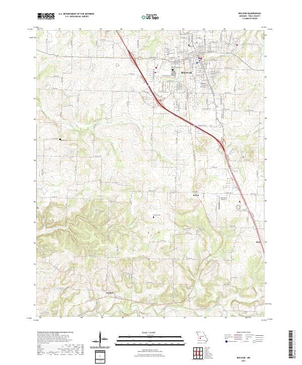
2021 Map of Bolivar
USGS Topo · Published 2021About this map
Polk County Courthouse stands as the central landmark of Bolivar, the seat of Polk County. The landscape here is defined by the transition from the structured urban grid of the city, which includes the campus of Southwest Baptist University, to the rolling drainage basins of Town Br and Bear Cr. A notable feature of this modern era is the Frisco Highline Trl, which follows a former railroad corridor south through the rural countryside toward Karlin and Wishart. This conversion reflects the evolution of the regional transportation network from steam-era rail to a recreational greenway. To the south, small family-named landmarks like Hensley Cem and Spencer Cem are scattered across the terrain near Walnut Cr and Tammie Cr, providing essential points of reference for genealogists tracing local families in these outlying areas.
Find a feature on this map
125 named features on this map. Tap any name to fly to it.
Don’t see what you’re looking for? This feature index may not catch every label — zoom into the map to look around manually.
Map Details
Editions of this 2021 Bolivar Map
This is the sole edition of this map. No revisions or reprints were ever made.
Other maps of this area

1884 · Springfield
USGS Topo · 1:125,000

1884 · Bolivar
USGS Topo · 1:125,000

1886 · Stockton
USGS Topo · 1:125,000

1886 · Greenfield
USGS Topo · 1:125,000

1886 · Springfield
USGS Topo · 1:125,000

1888 · Greenfield
USGS Topo · 1:125,000

1892 · Bolivar
USGS Topo · 1:125,000

1950 · Polk
USGS Topo · 1:24,000

1950 · Cliquot
USGS Topo · 1:24,000
1951 · Cliquot
USGS Topo · 1:24,000