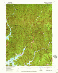
1957 Map of Bollibokka Mtn
USGS Topo · Published 1959About this map
The Shasta Lake reservoir dominates the lower portion of this landscape, its fingers reaching deep into the steep drainage of the Squaw Creek Arm and the Pit River. This mid-century survey captures a transition in land use, showing the site of the former mining hub at Bully Hill (Site) and the Bollibokka Club on the McCloud River. The terrain is strictly managed through a network of remote outposts, including the Madrone Guard Sta and the Squaw Creek Fire Control Sta, highlighting the area's importance to forest and fire management within the Shasta National Forest. Evidence of older rural life remains at the Wheeler Ranch and the Mineral Sch, while natural landmarks like Potem Falls and Devils Rock puncture the heavily ridged topography defined by Curl Ridge and Horse Ridge.
Find a feature on this map
88 named features on this map. Tap any name to fly to it.
Don’t see what you’re looking for? This feature index may not catch every label — zoom into the map to look around manually.
Map Details
Editions of this 1957 Bollibokka Mtn Map
2 editions found
Other maps of this area

1886 · Lassen Peak
USGS Topo · 1:250,000

1886 · Modoc Lava Bed
USGS Topo · 1:250,000

1886 · Shasta
USGS Topo · 1:250,000

1890 · Red Bluff
USGS Topo · 1:250,000

1892 · Modoc Lava-Bed
USGS Topo · 1:250,000

1892 · Lassen Peak
USGS Topo · 1:250,000

1894 · Lassen Peak
USGS Topo · 1:250,000

1894 · Red Bluff
USGS Topo · 1:250,000

1894 · Shasta
USGS Topo · 1:250,000

1901 · Redding
USGS Topo · 1:125,000