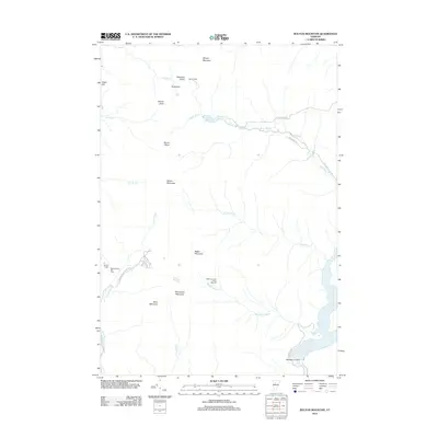
2012 Map of Bolton Mountain
USGS Topo · Published 2012About this map
Bolton Mountain and its surrounding peaks define this portion of the Green Mountains during the early 21st century. The landscape is characterized by a mix of recreational development and industrial remnants, most notably at the Waterbury Last Block Sawmill located near Stevenson Brook. The presence of Taylor Lodge and Bolton Lodge along the high ridges speaks to a long-standing hiking culture, while the Bolton Valley Ski Area occupies the western slopes accessed via Bolton Valley Access Rd.
Find a feature on this map
34 named features on this map. Tap any name to fly to it.
Don’t see what you’re looking for? This feature index may not catch every label — zoom into the map to look around manually.
Map Details
Editions of this 2012 Bolton Mountain Map
This is the sole edition of this map. No revisions or reprints were ever made.
Other maps of this area

1919 · Montpelier
USGS Topo · 1:62,500

1921 · Richmond
USGS Topo · 1:48,000

1921 · Montpelier
USGS Topo · 1:62,500

1924 · Camels Hump
USGS Topo · 1:62,500

1925 · Mount Mansfield
USGS Topo · 1:48,000

1927 · Mount Mansfield
USGS Topo · 1:62,500

1927 · Hyde Park
USGS Topo · 1:48,000

1930 · Hyde Park
USGS Topo · 1:62,500
1943 · Hyde Park
USGS Topo · 1:62,500

1944 · Montpelier
USGS Topo · 1:62,500