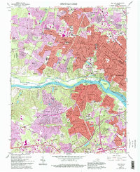
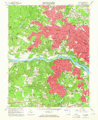
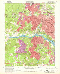
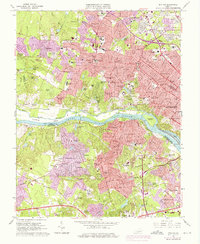
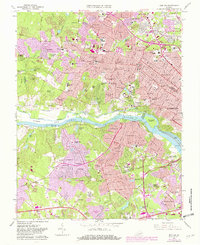
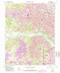
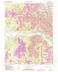
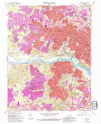
1964 Map of Bon Air
USGS Topo · Published 1994About this map
The James River corridor west of Richmond serves as the focal point of this mid-1960s study, showcasing the rapid suburban expansion into western Henrico and northern Chesterfield counties. The landscape is a mix of established academic grounds like the University of Richmond and historic industrial remnants, most notably the Bellona Arsenal Ruins situated near the riverbanks. Residential growth is visible in the emergence of neighborhoods such as Tuckahoe, Bon Air, and Stratford Hills, while older pockets like Ziontown and Gayton maintain their distinct identities. Transportation infrastructure, including the Chesapeake and Ohio Railroad and the historic Kanawha Canal, illustrates the area's long-standing connection to commerce and the river. Purple revision overlays from the late 1980s document the intensifying urbanization, specifically the development of the Chippenham Parkway and expanding school districts like Douglas-Freeman High Sch.
Find a feature on this map
123 named features on this map. Tap any name to fly to it.
Don’t see what you’re looking for? This feature index may not catch every label — zoom into the map to look around manually.
Map Details
Editions of this 1964 Bon Air Map
8 editions found
Other maps of this area

1890 · Goochland
USGS Topo · 1:125,000

1892 · Goochland
USGS Topo · 1:125,000

1894 · Bermuda Hundred
USGS Topo · 1:62,500

1894 · Richmond
USGS Topo · 1:62,500

1895 · Richmond
USGS Topo · 1:62,500

1897 · Amelia
USGS Topo · 1:125,000

1934 · Richmond
USGS Topo · 1:24,000

1936 · Richmond West
USGS Topo · 1:24,000

1936 · Glen Allen
USGS Topo · 1:24,000

1938 · Drewrys Bluff
USGS Topo · 1:24,000