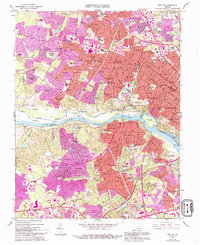
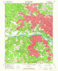
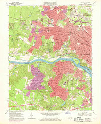
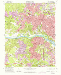
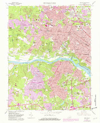
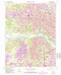
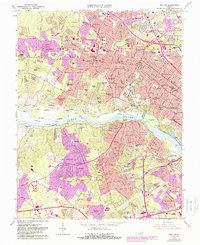
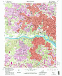
1964 Map of Bon Air
USGS Topo · Published 1994About this map
The James River corridor west of Richmond showcases a period of significant suburban expansion and institutional development in the mid-1960s. The landscape is defined by its educational and historical anchors, from the sprawling campus of the University of Richmond to the Bellona Arsenal Ruins situated along the southern bank. Transportation networks are a primary focus, featuring the intersection of the Richmond Fredericksburg and Potomac RR and the Chesapeake and Ohio RR, alongside the historic Kanawha Canal.
Find a feature on this map
124 named features on this map. Tap any name to fly to it.
Don’t see what you’re looking for? This feature index may not catch every label — zoom into the map to look around manually.
Map Details
Editions of this 1964 Bon Air Map
8 editions found
Other maps of this area

1890 · Goochland
USGS Topo · 1:125,000

1892 · Goochland
USGS Topo · 1:125,000

1894 · Bermuda Hundred
USGS Topo · 1:62,500

1894 · Richmond
USGS Topo · 1:62,500

1895 · Richmond
USGS Topo · 1:62,500

1897 · Amelia
USGS Topo · 1:125,000

1934 · Richmond
USGS Topo · 1:24,000

1936 · Richmond West
USGS Topo · 1:24,000

1936 · Glen Allen
USGS Topo · 1:24,000

1938 · Drewrys Bluff
USGS Topo · 1:24,000