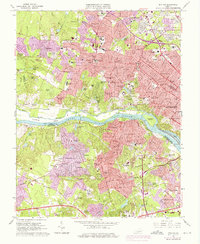
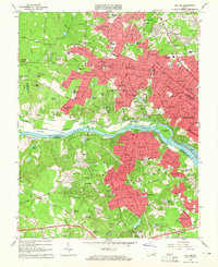
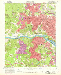
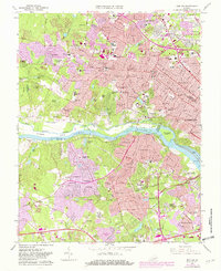
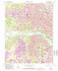
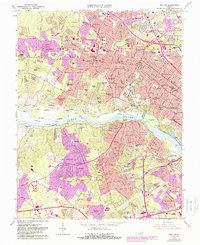
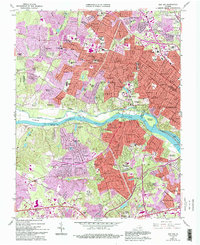
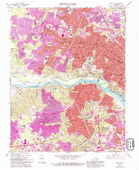
1964 Map of Bon Air
USGS Topo · Published 1976About this map
The James River serves as the central artery for this mid-1960s survey of the western suburbs of Richmond, where the expanding residential developments of Henrico Co and Chesterfield Co meet the water. Significant suburban growth is visible in the purple-tinted photorevisions, expanding outward from established neighborhoods like Westhampton and Crestview. The landscape preserves remnants of an earlier era, including the historic Bellona Arsenal Ruins and segments of the Chesapeake and Ohio Canal north of the river. Educational and spiritual centers are prominent, notably the University of Richmond campus centered on Westhampton Lake and numerous local landmarks such as St Marys Ch and Pinchbeck Sch. Transport networks define the terrain, from the Huguenot Memorial Bridge to the tracks of the Southern and Chesapeake and Ohio railroads that parallel the riverbanks and the winding Midlothian Turnpike.
Find a feature on this map
123 named features on this map. Tap any name to fly to it.
Don’t see what you’re looking for? This feature index may not catch every label — zoom into the map to look around manually.
Map Details
Editions of this 1964 Bon Air Map
8 editions found
Other maps of this area

1890 · Goochland
USGS Topo · 1:125,000

1892 · Goochland
USGS Topo · 1:125,000

1894 · Bermuda Hundred
USGS Topo · 1:62,500

1894 · Richmond
USGS Topo · 1:62,500

1895 · Richmond
USGS Topo · 1:62,500

1897 · Amelia
USGS Topo · 1:125,000

1934 · Richmond
USGS Topo · 1:24,000

1936 · Richmond West
USGS Topo · 1:24,000

1936 · Glen Allen
USGS Topo · 1:24,000

1938 · Drewrys Bluff
USGS Topo · 1:24,000