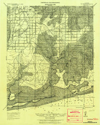
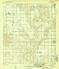
1921 Map of Bon Secour
USGS Topo · Published 1937About this map
Coastal Baldwin County is documented here during the early twentieth century, showing a landscape defined by tidewater inlets and nascent settlements. The southern terminus of the Ft Morgan and Bay Minette R R reaches into Foley, anchoring a local economy transition from timber to agriculture. Extensive tracts of Dead Woods are noted across the lowlands, reflecting the environmental conditions of the era before widespread coastal development.
Find a feature on this map
37 named features on this map. Tap any name to fly to it.
Don’t see what you’re looking for? This feature index may not catch every label — zoom into the map to look around manually.
Map Details
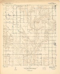
Editions of this 1921 Bon Secour Map
2 editions found
Other maps of this area
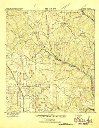
1920 · Robertsdale
USGS Topo · 1:62,500
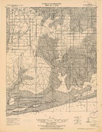
1921 · Bon Secour
USGS Topo · 1:62,500
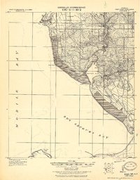
1921 · Point Clear
USGS Topo · 1:62,500

1921 · Fairhope
USGS Topo · 1:62,500

1921 · Fort Barrancas
USGS Topo · 1:62,500

1921 · Muscogee
USGS Topo · 1:62,500
1940 · Silverhill
USGS Topo · 1:31,680

1941 · Fort Barrancas
USGS Topo · 1:62,500
1941 · Silverhill
USGS Topo · 1:31,680

1941 · Muscogee
USGS Topo · 1:62,500