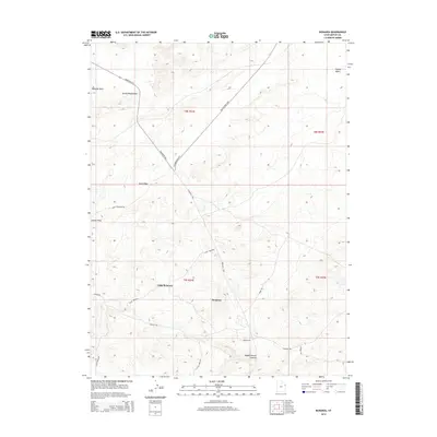
2014 Map of Bonanza
USGS Topo · Published 2014About this map
Bonanza and Little Bonanza anchor this high-desert landscape in northeastern Utah, where human infrastructure intersects with geological formations. The area is defined by a network of industrial and rural transit routes, including the S Bonanza Hwy and the winding Old Bonanza Hwy, alongside specialized paths like Hatch Reservoir Rd and Fiddler Rd. The terrain is marked by distinct natural landmarks such as the Devils Playground and Sand Ridge, while the drainage of the land is traced through Kennedy Wash and Coyote Wash. To the southeast, the topography descends into Wagon Hound Canyon, illustrating the transition from open basins like Coyote Basin into the deeply incised canyon systems typical of the Uintah Basin's edge.
Find a feature on this map
22 named features on this map. Tap any name to fly to it.
Don’t see what you’re looking for? This feature index may not catch every label — zoom into the map to look around manually.
Map Details
Editions of this 2014 Bonanza Map
This is the sole edition of this map. No revisions or reprints were ever made.
Other maps of this area

1885 · East Tavaputs
USGS Topo · 1:250,000

1885 · Ashley
USGS Topo · 1:250,000

1907 · Jensen
USGS Topo · 1:125,000

1910 · Jensen
USGS Topo · 1:125,000

1954 · Vernal
USGS Topo · 1:250,000

1956 · Grand Junction
USGS Topo · 1:250,000

1958 · Vernal
USGS Topo · 1:250,000

1959 · Grand Junction
USGS Topo · 1:250,000

1960 · Vernal
USGS Topo · 1:250,000

1960 · Grand Junction
USGS Topo · 1:250,000