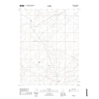
2020 Map of Bonanza
USGS Topo · Published 2020About this map
Bonanza and Little Bonanza serve as the primary human touchpoints in this arid Uintah County landscape, where the infrastructure of industry and transport cuts through distinctive desert terrain. The presence of the Eureka Vein suggests the subterranean geological interests that have long driven the region's economy, while roads like the Old Bonanza Hwy and Chipeta Wells Rd link these remote outposts. The map reveals a topography defined by significant natural landmarks, including the curiously named Devils Playground and the expansive Sand Ridge. To the south, Wagon Hound Canyon provides a stark contrast to the northern Coyote Basin, illustrating a complex network of washes and ridges that characterize this part of the Uinta Basin during the early twenty-first century.
Find a feature on this map
11 named features on this map. Tap any name to fly to it.
Don’t see what you’re looking for? This feature index may not catch every label — zoom into the map to look around manually.
Map Details
Editions of this 2020 Bonanza Map
This is the sole edition of this map. No revisions or reprints were ever made.
Other maps of this area

1885 · East Tavaputs
USGS Topo · 1:250,000

1885 · Ashley
USGS Topo · 1:250,000

1907 · Jensen
USGS Topo · 1:125,000

1910 · Jensen
USGS Topo · 1:125,000

1954 · Vernal
USGS Topo · 1:250,000

1956 · Grand Junction
USGS Topo · 1:250,000

1958 · Vernal
USGS Topo · 1:250,000

1959 · Grand Junction
USGS Topo · 1:250,000

1960 · Vernal
USGS Topo · 1:250,000

1960 · Grand Junction
USGS Topo · 1:250,000