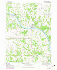
1968 Map of Bonaparte
USGS Topo · Published 1983About this map
The Des Moines River carves a deep valley through Van Buren County, anchoring the historic riverfront communities of Bonaparte, Bentonsport, and Vernon. This 1968 field survey documents a landscape of steep, wooded ravines and creek drainages, including Honey Creek and Bear Creek, which separate the agricultural uplands. A striking feature of the local infrastructure is the Old Railroad Grade winding through the hills south of the river, marking the path of former transportation routes that once linked these valley towns to wider markets.
Find a feature on this map
46 named features on this map. Tap any name to fly to it.
Don’t see what you’re looking for? This feature index may not catch every label — zoom into the map to look around manually.
Map Details
Editions of this 1968 Bonaparte Map
2 editions found
Other maps of this area

1958 · Burlington
USGS Topo · 1:250,000

1961 · Burlington
USGS Topo · 1:250,000

1963 · Burlington
USGS Topo · 1:250,000

1968 · Anson
USGS Topo · 1:24,000

1968 · Bonaparte
USGS Topo · 1:24,000
1968 · Croton
USGS Topo · 1:24,000

1968 · Keosauqua
USGS Topo · 1:24,000

1968 · Farmington
USGS Topo · 1:24,000
1968 · Mount Sterling
USGS Topo · 1:24,000
1981 · Mount Zion
USGS Topo · 1:24,000