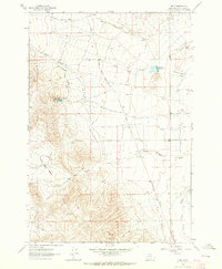
1962 Map of Bond
USGS Topo · Published 1964About this map
The Union Pacific railroad corridor anchors this high-plains landscape in Beaverhead County, defining a narrow strip of development at Bond and Nelson during the early 1960s. The region is characterized by a sophisticated network of irrigation and water management features necessary for agriculture in this arid terrain, including the Willow Creek Ditch, Beaverhead Water Company Ditch, and Murray Ditch. These systems parallel the natural drainage of Willard Slough and Gilbert Slough, showing the intensive human effort to redirect water toward the valley floor.
Find a feature on this map
24 named features on this map. Tap any name to fly to it.
Don’t see what you’re looking for? This feature index may not catch every label — zoom into the map to look around manually.
Map Details
Editions of this 1962 Bond Map
2 editions found
Other maps of this area

1893 · Dillon
USGS Topo · 1:250,000

1952 · Twin Adams Mountain
USGS Topo · 1:24,000

1952 · Argenta
USGS Topo · 1:24,000

1952 · Burns Mountain
USGS Topo · 1:24,000

1955 · Dillon
USGS Topo · 1:250,000

1957 · Dillon
USGS Topo · 1:250,000

1958 · Dillon
USGS Topo · 1:250,000

1960 · Glen
USGS Topo · 1:24,000

1960 · Block Mountain
USGS Topo · 1:24,000

1961 · Glen SE
USGS Topo · 1:24,000