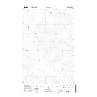
2014 Map of Bonetraill
USGS Topo · Published 2014About this map
Bonetraill and the surrounding high plains of Williams County are defined by a rhythmic grid of rural section roads and ephemeral drainage patterns. This 2014 survey captures a quiet agricultural landscape where the settlement of Gladys sits in the north, while Heidemann Coulee and the meandering Blacktail Cr carve through the prairie terrain. The map documents the persistent layout of the rural township system, marked by numbered routes like 74th St NW and 147th Ave NW. Aviation and recreation are localized at the Hought Airstrip and the waters of Blacktail Lake, reflecting the practical and social uses of the land in the modern era. The topography reveals the subtle elevation changes characteristic of this portion of the Missouri Plateau, where small coulees and creeks provide the only significant breaks in the vast, open horizon.
Find a feature on this map
18 named features on this map. Tap any name to fly to it.
Don’t see what you’re looking for? This feature index may not catch every label — zoom into the map to look around manually.
Map Details
Editions of this 2014 Bonetraill Map
This is the sole edition of this map. No revisions or reprints were ever made.
Other maps of this area

1948 · Grenora
USGS Topo · 1:24,000

1948 · Hanks
USGS Topo · 1:24,000

1948 · Zahl
USGS Topo · 1:24,000

1953 · Williston
USGS Topo · 1:250,000

1957 · Williston
USGS Topo · 1:250,000

1974 · Blacktail Lake
USGS Topo · 1:24,000

1974 · Bonetraill
USGS Topo · 1:24,000

1974 · Otter Tail Creek
USGS Topo · 1:24,000

1974 · West Bonetraill
USGS Topo · 1:24,000

1974 · Bonetraill SW
USGS Topo · 1:24,000