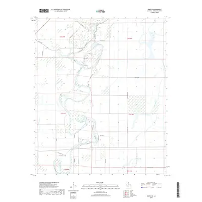
2018 Map of Bonita SW
USGS Topo · Published 2018About this map
Bayou Bonne Idee meanders through the heart of this Morehouse Parish landscape, defining the local topography and drainage patterns. The 2018 survey reveals a rural area predominantly shaped by its water systems, including the slow-moving reaches of Bayou Galion and Cypress Bayou. These waterways are flanked by numerous low-lying features such as The Swale and Little Brake, indicating the characteristic wetland ecology of northern Louisiana. Local history and family genealogy are grounded in markers like the Heart Cem and a network of parish roads that frequently bear the names of local residents, such as Louis White Rd, Clem Payne Rd, and Claude Deville Rd. The presence of Johnson School Rd and Baily Store Rd suggests the locations of former community centers that once served this agricultural region.
Find a feature on this map
42 named features on this map. Tap any name to fly to it.
Don’t see what you’re looking for? This feature index may not catch every label — zoom into the map to look around manually.
Map Details
Editions of this 2018 Bonita SW Map
This is the sole edition of this map. No revisions or reprints were ever made.
Other maps of this area

1935 · Collinston
USGS Topo · 1:62,500

1935 · Naff
USGS Topo · 1:62,500

1935 · Hurricane
USGS Topo · 1:62,500

1935 · Bonita
USGS Topo · 1:62,500

1955 · Jackson
USGS Topo · 1:250,000

1956 · Bastrop
USGS Topo · 1:62,500

1957 · Collinston
USGS Topo · 1:62,500

1958 · Hurricane
USGS Topo · 1:62,500

1958 · Bonita
USGS Topo · 1:62,500

1961 · Jackson
USGS Topo · 1:250,000