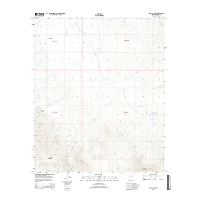
2014 Map of Bonita Tank
USGS Topo · Published 2014About this map
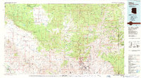
The Gila Mountains and the peak of Slaughter Mountain anchor this landscape in Graham County, where deep drainages like Paymaster Canyon and Paymaster Wash cut through the arid terrain. The water management system of the high desert is prominently displayed through a network of cattle tanks and catchment basins, including Bonita Tank, Paymaster Tank, and the Steer Pasture Tank. These features, alongside ephemeral waterways like Bonita Cr and Sevenmile Cr, reflect the vital infrastructure required for ranching in this portion of Arizona. Transportation is represented by tribal routes Bia-11 and Bia-18, which navigate the broad expanse of Ash Flat to the north, connecting the rugged uplands with more level grazing grounds.
Find a feature on this map
23 named features on this map. Tap any name to fly to it.
Don’t see what you’re looking for? This feature index may not catch every label — zoom into the map to look around manually.
Map Details
Editions of this 2014 Bonita Tank Map
This is the sole edition of this map. No revisions or reprints were ever made.
Other maps of this area

1954 · Clifton
USGS Topo · 1:250,000

1957 · Clifton
USGS Topo · 1:250,000

1958 · Clifton
USGS Topo · 1:250,000

1960 · Fort Thomas
USGS Topo · 1:62,500

1962 · Clifton
USGS Topo · 1:250,000

1962 · Bryce Mountain
USGS Topo · 1:62,500
1967 · Point of Pines East
USGS Topo · 1:24,000
1967 · Point of Pines West
USGS Topo · 1:24,000
1967 · Tule Tubs
USGS Topo · 1:24,000
1986 · Clifton
USGS Topo · 1:100,000