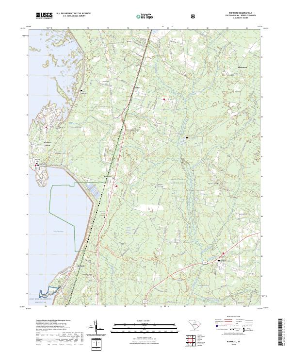
2024 Map of Bonneau
USGS Topo · Published 2024About this map
Lake Moultrie defines the western edge of this Berkeley County landscape, where the waters meet the established settlements of Bonneau and Bonneau Beach. The interior is characterized by the dense woodlands of the Francis Marion National Forest, interspersed with low-lying wetlands such as Gravel Hill Swamp and Wadboo Swamp. This modern survey reveals a complex network of local roads like Pooshee Plntn Rd and Trinity Church Rd, which connect rural communities and historical burial sites. For those researching local lineages, the map identifies numerous small cemeteries and graveyards, including the Black Oak Cem and the Providence Church Graveyard. The southern portion includes the Macbeth area and the military recreation grounds at Joint Base Charleston Short Stay, showing how contemporary land use integrates with the natural drainages of Wadboo Creek and Whiskinboo Creek.
Find a feature on this map
98 named features on this map. Tap any name to fly to it.
Don’t see what you’re looking for? This feature index may not catch every label — zoom into the map to look around manually.
Map Details
Editions of this 2024 Bonneau Map
This is the sole edition of this map. No revisions or reprints were ever made.
Other maps of this area

1919 · Summerville
USGS Topo · 1:48,000

1919 · Cordesville
USGS Topo · 1:48,000

1920 · Chicora
USGS Topo · 1:48,000

1920 · Summerville
USGS Topo · 1:62,500

1921 · Chicora
USGS Topo · 1:62,500

1943 · Chicora
USGS Topo · 1:62,500

1943 · Bonneau
USGS Topo · 1:62,500

1944 · Summerville
USGS Topo · 1:62,500

1948 · Cordesville
USGS Topo · 1:24,000

1948 · Bethera
USGS Topo · 1:24,000