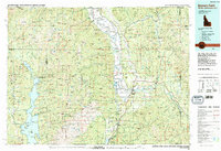
1983 Map of Bonners Ferry
USGS Topo · Published 1983About this map
Bonners Ferry serves as the hub of this Idaho Panhandle landscape, where the Kootenai River makes its wide bend through the Purcell Trench. The 1980s terrain is defined by the heavy presence of the Kaniksu National Forest and the Selkirk Crest, providing a detailed look at the region's mining and conservation history. Scattered throughout the peaks are several named workings, including the Golden Scepter Mine and Bethlehem Mine, reflecting the area's extraction-based economy.
Find a feature on this map
224 named features on this map. Tap any name to fly to it.
Don’t see what you’re looking for? This feature index may not catch every label — zoom into the map to look around manually.
Map Details
Editions of this 1983 Bonners Ferry Map
2 editions found
Other maps of this area

1901 · Sandpoint
USGS Topo · 1:125,000

1911 · Priest Lake
USGS Topo · 1:250,000

1911 · Sandpoint
USGS Topo · 1:125,000

1913 · Priest Lake
USGS Topo · 1:250,000

1920 · Libby
USGS Topo · 1:125,000

1930 · Libby
USGS Topo · 1:125,000

1932 · Libby
USGS Topo · 1:125,000

1934 · Metaline
USGS Topo · 1:125,000

1936 · Newport
USGS Topo · 1:96,000

1942 · Metaline
USGS Topo · 1:125,000