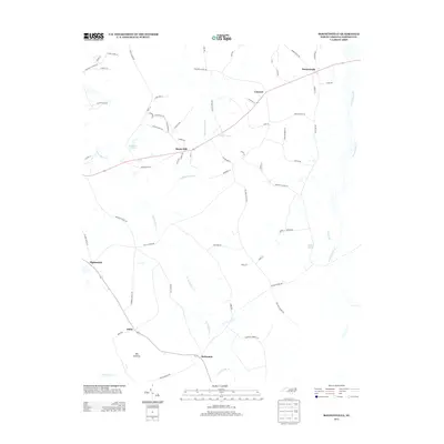
2013 Map of Bonnetsville
USGS Topo · Published 2013About this map
Great Coharie Creek defines the eastern boundary of this Sampson County landscape, a region characterized by its intricate drainage networks and rural settlements. The terrain is a mosaic of riparian environments and small communities, with the slow-moving waters of Bearskin Swamp and Little Coharie Creek carving through the heart of the area. Local agriculture and history are anchored by long-standing points of interest like Snow Hill and Bonnetsville, which sit amidst a web of family-named roads. To the south, the presence of Lockamy Mill Br and Old Savanna speaks to the early industrial and environmental character of the land. This map provides a detailed look at the rural infrastructure in the early 21st century, showing how the original settlement patterns around McDaniels, Mintz, and Concord have persisted alongside water bodies like Halls Pond and Hobbs Pond.
Find a feature on this map
70 named features on this map. Tap any name to fly to it.
Don’t see what you’re looking for? This feature index may not catch every label — zoom into the map to look around manually.
Map Details
Editions of this 2013 Bonnetsville Map
This is the sole edition of this map. No revisions or reprints were ever made.
Other maps of this area

1909 · Coharie
USGS Topo · 1:62,500

1953 · Florence
USGS Topo · 1:250,000

1953 · Raleigh
USGS Topo · 1:250,000

1954 · Florence
USGS Topo · 1:250,000

1954 · Raleigh
USGS Topo · 1:250,000

1959 · Roseboro
USGS Topo · 1:62,500

1959 · Garland
USGS Topo · 1:62,500

1974 · Salemburg
USGS Topo · 1:24,000

1982 · Elizabethtown
USGS Topo · 1:100,000
1986 · Ingold
USGS Topo · 1:24,000