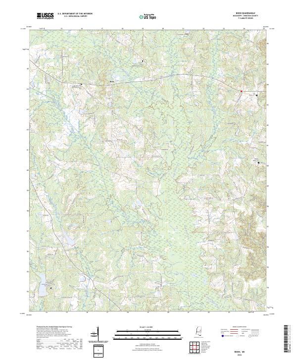
2024 Map of Boon
USGS Topo · Published 2024About this map
The settlement of Boon sits at a rural crossroads in northern Winston County, Mississippi, where small creek systems like Murphy Creek and Nanih Waiya Creek drain a landscape of managed timber and agricultural plots. This contemporary survey details a region deeply rooted in its local institutions, evidenced by the clustered Murphy Creek Baptist Church Cem and New Hope Methodist Church Cem. The map reveals a high density of family-named landmarks and rural routes, such as Ellison Ridge RD and Sammy Black RD, which link isolated homesteads and community burial grounds like the Kirk Family Cem. A significant portion of the central terrain is designated as the Farm Service Agency Interest of Mississippi, illustrating the modern intersection of federal land management and private agriculture in the Deep South. The intricate drainage network of Coopwood Creek and Town Creek further defines the topography of this quiet rural corridor.
Find a feature on this map
75 named features on this map. Tap any name to fly to it.
Don’t see what you’re looking for? This feature index may not catch every label — zoom into the map to look around manually.
Map Details
Editions of this 2024 Boon Map
This is the sole edition of this map. No revisions or reprints were ever made.
Other maps of this area

1953 · Meridian
USGS Topo · 1:250,000

1953 · West Point
USGS Topo · 1:250,000

1957 · Meridian
USGS Topo · 1:250,000

1958 · West Point
USGS Topo · 1:250,000

1962 · Vernon
USGS Topo · 1:24,000

1962 · Preston
USGS Topo · 1:24,000

1963 · West Point
USGS Topo · 1:250,000

1965 · Meridian
USGS Topo · 1:250,000

1972 · Louisville North
USGS Topo · 1:24,000
1972 · Noxapater
USGS Topo · 1:24,000