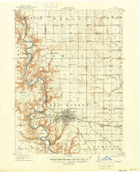
1916 Map of Boone
USGS Topo · Published 1943About this map
The Des Moines River carves a deep, winding valley through this central Iowa landscape, defining the topography of the region before the First World War. The city of Boone serves as a major rail hub, where the Chicago and Northwestern intersects with the Fort Dodge Des Moines and Southern and the Chicago Milwaukee and St Paul railroads. This dense network of tracks facilitated the movement of coal and agricultural goods, supporting riverfront settlements like Fraser, Logansport, and Moingona.
Find a feature on this map
69 named features on this map. Tap any name to fly to it.
Don’t see what you’re looking for? This feature index may not catch every label — zoom into the map to look around manually.
Map Details
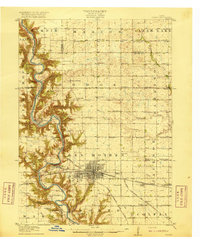
Editions of this 1916 Boone Map
3 editions found
Other maps of this area

1911 · Madrid
USGS Topo · 1:62,500

1911 · Slater
USGS Topo · 1:62,500

1912 · Ames
USGS Topo · 1:62,500

1913 · Slater
USGS Topo · 1:62,500

1914 · Madrid
USGS Topo · 1:62,500

1914 · Ames
USGS Topo · 1:62,500

1916 · Boone
USGS Topo · 1:62,500

1923 · Lehigh
USGS Topo · 1:62,500

1950 · Perry
USGS Topo · 1:62,500

1951 · Perry
USGS Topo · 1:62,500