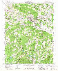
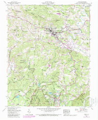
1959 Map of Boone
USGS Topo · Published 1968About this map
Boone serves as the focal point of this late-1950s survey, home to the Appalachian State Teachers College and the Daniel Boone Theater. The landscape is a complex intersection of the Blue Ridge Parkway and the tourist and timber legacies of Watauga County. To the south, the resort character of Blowing Rock is fully established, bordered by the expansive grounds of Moses H Cone Memorial Park and Julian Price Memorial Park.
Find a feature on this map
123 named features on this map. Tap any name to fly to it.
Don’t see what you’re looking for? This feature index may not catch every label — zoom into the map to look around manually.
Map Details
Editions of this 1959 Boone Map
5 editions found
Other maps of this area

1893 · Cranberry
USGS Topo · 1:125,000

1895 · Cranberry
USGS Topo · 1:125,000

1899 · Cranberry
USGS Topo · 1:125,000

1902 · Cranberry
USGS Topo · 1:125,000

1934 · Valle Crucis
USGS Topo · 1:24,000

1934 · Boone
USGS Topo · 1:24,000

1935 · Doe Mountain
USGS Topo · 1:48,000

1935 · Sherwood
USGS Topo · 1:24,000

1935 · Zionville
USGS Topo · 1:24,000

1936 · Blowing Rock
USGS Topo · 1:48,000