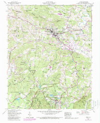
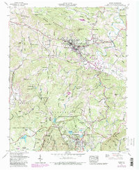
1959 Map of Boone
USGS Topo · Published 1989About this map
Boone serves as the focal point for this survey, showing the growth of Appalachian State Teachers College and the surrounding neighborhoods of Hillerest and Perkinsville. The landscape is defined by the high peaks of Rich Mountain and Howard Knob, which overlook a network of family farms and mountain churches like Howard Creek Ch and Mt View Ch. To the south, the development of leisure and conservation is evident through the extensive grounds of Moses H Cone Memorial Park and Julian Price Memorial Park. The map documents a period of significant recreational growth, featuring sites like Camp Sky Ranch and the Boone Golf Course. Cultural and historic landmarks are numerous, including the Tweetsie RR and the Craft center near Bass Lake, illustrating the intersection of traditional Appalachian mountain life and the emerging tourism economy along the Blue Ridge Parkway.
Find a feature on this map
121 named features on this map. Tap any name to fly to it.
Don’t see what you’re looking for? This feature index may not catch every label — zoom into the map to look around manually.
Map Details
Editions of this 1959 Boone Map
5 editions found
Other maps of this area

1893 · Cranberry
USGS Topo · 1:125,000

1895 · Cranberry
USGS Topo · 1:125,000

1899 · Cranberry
USGS Topo · 1:125,000

1902 · Cranberry
USGS Topo · 1:125,000

1934 · Valle Crucis
USGS Topo · 1:24,000

1934 · Boone
USGS Topo · 1:24,000

1935 · Doe Mountain
USGS Topo · 1:48,000

1935 · Sherwood
USGS Topo · 1:24,000

1935 · Zionville
USGS Topo · 1:24,000

1936 · Blowing Rock
USGS Topo · 1:48,000