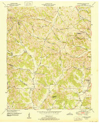
1951 Map of Booneville
USGS Topo · Published 1951About this map
Lynchburg and the surrounding rural hollows of Moore County are documented here following a 1949 field examination. The landscape is defined by its deep, family-named drainages, such as Possumtrot Hollow, John Allen Hollow, and Wiseman Hollow, which illustrate the traditional settlement patterns of the Highland Rim. Community life is centered on landmarks like New Herman and Booneville, with rural infrastructure including the Charity Sch West and several country churches like Buckeye Ch. Genealogists will find a wealth of burial grounds, including the Motlow Cem and Morris Cem, many of which are tucked away near small watercourses like Mulberry Creek. The map also captures geological features such as Ward Cave and early transit routes like Wiseman Road that bridged the rugged gaps between Bedford and Moore counties.
Find a feature on this map
64 named features on this map. Tap any name to fly to it.
Don’t see what you’re looking for? This feature index may not catch every label — zoom into the map to look around manually.
Map Details
Editions of this 1951 Booneville Map
2 editions found
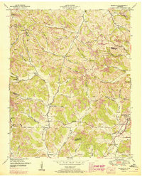
Other maps of this area

1936 · Booneville
USGS Topo · 1:24,000

1936 · Shelbyville
USGS Topo · 1:24,000

1936 · Cumberland Springs
USGS Topo · 1:24,000

1936 · Belleville
USGS Topo · 1:24,000

1936 · Bedford
USGS Topo · 1:24,000

1936 · Mulberry
USGS Topo · 1:24,000

1936 · Normandy
USGS Topo · 1:24,000

1936 · Fayetteville
USGS Topo · 1:24,000

1936 · Lois
USGS Topo · 1:24,000

1941 · Cumberland Springs
USGS Topo · 1:24,000