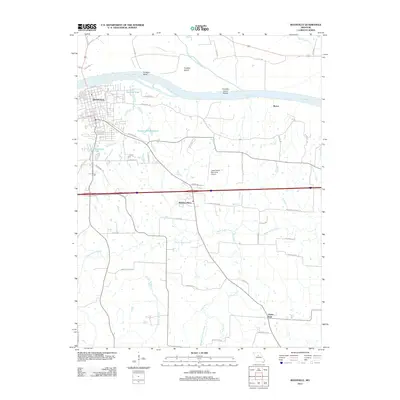
2011 Map of Boonville
USGS Topo · Published 2011About this map
The Boonville riverfront dominates the northern reaches of this Missouri landscape, situated where the Missouri River curves around Franklin Bend and the expansive Franklin Island. This 2011 survey documents a mix of historic river navigation sites and modern aviation infrastructure, notably the Jesse Viertel Memorial Airport positioned centrally between the river and the interstate corridor.
Find a feature on this map
54 named features on this map. Tap any name to fly to it.
Don’t see what you’re looking for? This feature index may not catch every label — zoom into the map to look around manually.
Map Details
Editions of this 2011 Boonville Map
This is the sole edition of this map. No revisions or reprints were ever made.
Other maps of this area

1888 · Boonville
USGS Topo · 1:125,000

1890 · Glasgow
USGS Topo · 1:125,000

1947 · Glasgow
USGS Topo · 1:62,500

1947 · Jefferson City
USGS Topo · 1:250,000

1952 · Rocheport
USGS Topo · 1:24,000

1952 · Boonville
USGS Topo · 1:24,000

1952 · New Franklin
USGS Topo · 1:24,000
1952 · Prairie Home
USGS Topo · 1:24,000

1952 · Hilldale
USGS Topo · 1:24,000

1952 · Lone Elm
USGS Topo · 1:24,000