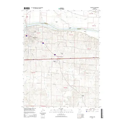
2015 Map of Boonville
USGS Topo · Published 2015About this map
The Missouri River defines the northern reaches of this Missouri landscape, sweeping past Franklin Bend and the expansive Franklin Island. South of the river, the city of Boonville sits at a critical junction of modern transit and historical corridors, where the Katy Trl traces the path of the former Missouri-Kansas-Texas Railroad. The town’s layout is documented down to specific street names like Sycamore St and Bingham Rd, while Walnut Grove Cemetery marks a significant point of local heritage near the river bluffs.
Find a feature on this map
61 named features on this map. Tap any name to fly to it.
Don’t see what you’re looking for? This feature index may not catch every label — zoom into the map to look around manually.
Map Details
Editions of this 2015 Boonville Map
This is the sole edition of this map. No revisions or reprints were ever made.
Other maps of this area

1888 · Boonville
USGS Topo · 1:125,000

1890 · Glasgow
USGS Topo · 1:125,000

1947 · Glasgow
USGS Topo · 1:62,500

1947 · Jefferson City
USGS Topo · 1:250,000

1952 · Rocheport
USGS Topo · 1:24,000

1952 · Boonville
USGS Topo · 1:24,000

1952 · New Franklin
USGS Topo · 1:24,000
1952 · Prairie Home
USGS Topo · 1:24,000

1952 · Hilldale
USGS Topo · 1:24,000

1952 · Lone Elm
USGS Topo · 1:24,000