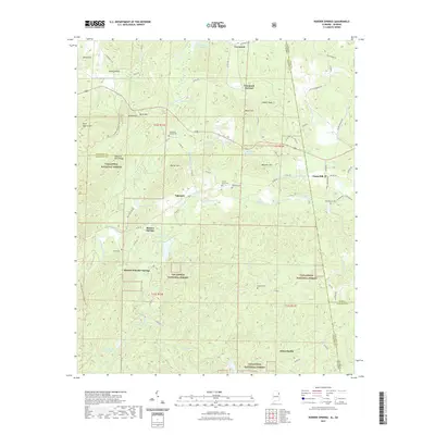
2021 Map of Borden Springs
USGS Topo · Published 2021About this map
Borden Wheeler Springs and the surrounding woodlands of the Talladega National Forest dominate this landscape along the Alabama and Georgia border. The map documents a region defined by its industrial and social history, notably at Tecumseh Furnace and the ridges of Augusta Mine Ridge, where mineral extraction once shaped local life. Water is a central element of the geography, from the complex drainage of Terrapin Cr to family-named landmarks like McGee Lake and Snows Lake. Small communities such as Palestine and Esom Hill are connected by a network of county roads, while the Pinhoti National Recreation Trail winds through the hills for those following the ridgelines. Numerous burial grounds, including Arrington Chapel Cem and Williams Cem, provide valuable geographic markers for those researching the early families of Cleburne and Cherokee counties.
Find a feature on this map
94 named features on this map. Tap any name to fly to it.
Don’t see what you’re looking for? This feature index may not catch every label — zoom into the map to look around manually.
Map Details
Editions of this 2021 Borden Springs Map
This is the sole edition of this map. No revisions or reprints were ever made.
Other maps of this area

1886 · Rome
USGS Topo · 1:125,000

1889 · Tallapoosa
USGS Topo · 1:125,000

1892 · Tallapoosa
USGS Topo · 1:125,000

1893 · Fort Payne
USGS Topo · 1:125,000

1897 · Tallapoosa
USGS Topo · 1:125,000

1898 · Rome
USGS Topo · 1:125,000

1898 · Fort Payne
USGS Topo · 1:125,000

1899 · Rome
USGS Topo · 1:125,000

1900 · Fort Payne
USGS Topo · 1:125,000

1900 · Anniston
USGS Topo · 1:125,000