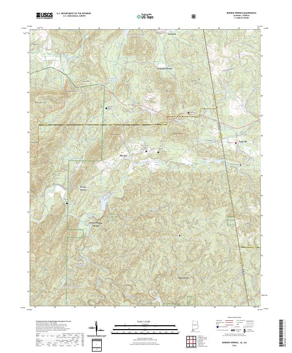
2024 Map of Borden Springs
USGS Topo · Published 2024About this map
The Talladega National Forest blankets the rugged terrain where the Alabama and Georgia state lines meet, framing a landscape defined by its industrial and social history. The map highlights the legacy of iron production at Tecumseh Furnace, situated north of Edwardsville and the crossing of Terrapin Creek. This region served as a vital corridor for early settlers, as evidenced by the cluster of burial grounds like Arrington Chapel Cem and Cherry Grove Original Church Cem.
Find a feature on this map
90 named features on this map. Tap any name to fly to it.
Don’t see what you’re looking for? This feature index may not catch every label — zoom into the map to look around manually.
Map Details
Editions of this 2024 Borden Springs Map
This is the sole edition of this map. No revisions or reprints were ever made.
Other maps of this area

1886 · Rome
USGS Topo · 1:125,000

1889 · Tallapoosa
USGS Topo · 1:125,000

1892 · Tallapoosa
USGS Topo · 1:125,000

1893 · Fort Payne
USGS Topo · 1:125,000

1897 · Tallapoosa
USGS Topo · 1:125,000

1898 · Rome
USGS Topo · 1:125,000

1898 · Fort Payne
USGS Topo · 1:125,000

1899 · Rome
USGS Topo · 1:125,000

1900 · Fort Payne
USGS Topo · 1:125,000

1900 · Anniston
USGS Topo · 1:125,000