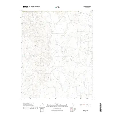
2019 Map of Borger SE
USGS Topo · Published 2019About this map
Dixon Creek and its extensive network of tributaries, including W Dixon Cr, Middle Dixon Cr, and E Dixon Cr, dominate this section of the Texas Panhandle near the border of Carson Co. The landscape is defined by the intricate erosion patterns of these drainages as they carve through the high plains south of the Canadian River valley. The hydrology here is complex, with the Bear Cr system, featuring both the W Fork Bear Cr and E Fork Bear Cr, flowing through the central and southern portions of the quadrangle. In the eastern reaches, the land rises toward the headwaters of Spring Cr. While largely rural and dominated by natural topography, the map shows the transition into more developed territory near E Camp Rd, reflecting the area's history of ranching and oil-related infrastructure typical of the region.
Find a feature on this map
10 named features on this map. Tap any name to fly to it.
Don’t see what you’re looking for? This feature index may not catch every label — zoom into the map to look around manually.
Map Details
Editions of this 2019 Borger SE Map
This is the sole edition of this map. No revisions or reprints were ever made.
Other maps of this area

1953 · Borger SE
USGS Topo · 1:24,000

1953 · McBride
USGS Topo · 1:24,000

1953 · Phillips
USGS Topo · 1:24,000

1953 · Borger
USGS Topo · 1:24,000

1954 · Amarillo
USGS Topo · 1:250,000

1958 · Amarillo
USGS Topo · 1:250,000

1963 · Skellytown
USGS Topo · 1:24,000

1965 · White Deer
USGS Topo · 1:24,000

1965 · Abell
USGS Topo · 1:24,000

1966 · Cuyler
USGS Topo · 1:24,000