
1914 Map of Boring
USGS Topo · Published 1914About this map
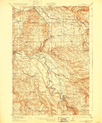
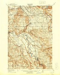
The Clackamas River and Sandy River define this 1914 landscape, where the early electric and logging rail systems of the Portland Railway Light and Power Company dictated the pace of growth. The map captures a transition in transport, showing the Cazadero (Logging Railway) and several logging spurs snaking through the timbered hills near Boring and Estacada. Before the era of widespread bridges, river crossings were vital, evidenced by the McMurray Ferry and Feldheimer Ferry.
Find a feature on this map
77 named features on this map. Tap any name to fly to it.
Don’t see what you’re looking for? This feature index may not catch every label — zoom into the map to look around manually.
Map Details
Editions of this 1914 Boring Map
3 editions found
Other maps of this area

1897 · Portland
USGS Topo · 1:62,500

1905 · Portland
USGS Topo · 1:62,500

1911 · Boring
USGS Topo · 1:48,000

1914 · Oregon City
USGS Topo · 1:62,500

1916 · Estacada
USGS Topo · 1:125,000

1918 · Troutdale
USGS Topo · 1:62,500

1934 · Troutdale
USGS Topo · 1:48,000

1939 · Molalla
USGS Topo · 1:62,500

1939 · Oregon City
USGS Topo · 1:62,500

1940 · Molalla
USGS Topo · 1:62,500