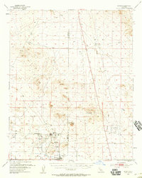
1954 Map of Boron
USGS Topo · Published 1959About this map
Industrial and military activity define this Mojave Desert landscape, concentrated along the A T & S F railroad corridor. The area shows the transition of local identity near the Kern and San Bernardino county line, where Baker serves as the primary post office near West Baker and the emerging town of Boron. The presence of the Jennifer Mine, extensive Tailings, and a Tailings Pond underscores the significance of local mining operations to the mid-century economy.
Find a feature on this map
21 named features on this map. Tap any name to fly to it.
Don’t see what you’re looking for? This feature index may not catch every label — zoom into the map to look around manually.
Map Details
Editions of this 1954 Boron Map
3 editions found
Other maps of this area

1903 · Randsburg
USGS Topo · 1:62,500

1911 · Randsburg
USGS Topo · 1:62,500

1912 · Randsburg
USGS Topo · 1:62,500

1915 · Searles Lake
USGS Topo · 1:250,000

1932 · Barstow
USGS Topo · 1:125,000

1934 · Barstow
USGS Topo · 1:125,000

1937 · Kramer
USGS Topo · 1:48,000

1937 · Rogers Lake
USGS Topo · 1:48,000

1942 · Kramer
USGS Topo · 1:62,500

1942 · Rogers Lake
USGS Topo · 1:62,500