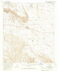
1960 Map of Borrego Mountain
USGS Topo · Published 1966About this map
Ocotillo Wells and the surrounding high desert terrain define this mid-century survey of the San Diego and Imperial County border. The landscape is a network of ephemeral drainages, including the prominent San Felipe Wash and Fish Creek Wash, which carve through the Borrego Badlands. Traces of human activity are scattered throughout, from the Little Borrego (Site) and the Los Puertocitos Historical Marker to various dry wells such as Baileys Well. Significant geologic landmarks like the Pumpkin Patch, Shell Reef, and the narrow canyon known as The Slot reflect the area's distinct natural character. The survey also captures the southern portion of Anza-Borrego Desert State Park, featuring the Elephant Tree Area and the stark white terrain of the Mud Palisades near Split Mountain.
Find a feature on this map
48 named features on this map. Tap any name to fly to it.
Don’t see what you’re looking for? This feature index may not catch every label — zoom into the map to look around manually.
Map Details
Editions of this 1960 Borrego Mountain Map
2 editions found
Other maps of this area

1904 · Indio
USGS Topo · 1:125,000

1915 · El Centro
USGS Topo · 1:125,000

1931 · Vallecito
USGS Topo · 1:125,000

1931 · Carrizo
USGS Topo · 1:125,000

1939 · Borrego
USGS Topo · 1:62,500

1940 · Kane Spring
USGS Topo · 1:62,500

1940 · Plaster City
USGS Topo · 1:62,500

1940 · Durmid
USGS Topo · 1:62,500

1941 · Clark Lake
USGS Topo · 1:62,500

1942 · Barrel Spring
USGS Topo · 1:62,500