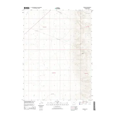
2015 Map of Bosler SE
USGS Topo · Published 2015About this map
The eastern reaches of Albany County rise into the Laramie Mountains in this 2015 survey, where the high-altitude topography is defined by significant elevation changes and drainage networks. Narrow ranch roads, including Middle Creek Ranch Rd and Gates Creek Ranch Rd, trace the winding contours of the upland terrain, providing access to remote sections of the range. The landscape is carved by watercourses such as Wallrock Cr and Gates Cr, which drain the eastern slopes toward the plains. This map illustrates the intersection of large-scale ranching interests and the physical geography of the Wyoming interior, with routes like Wall Canyon Rd and Pascoe Ranch Rd marking the sparse human footprint across the mountain transition.
Find a feature on this map
11 named features on this map. Tap any name to fly to it.
Don’t see what you’re looking for? This feature index may not catch every label — zoom into the map to look around manually.
Map Details
Editions of this 2015 Bosler SE Map
This is the sole edition of this map. No revisions or reprints were ever made.
Other maps of this area

1895 · Laramie
USGS Topo · 1:125,000

1902 · Laramie
USGS Topo · 1:125,000

1905 · Sherman
USGS Topo · 1:125,000

1905 · Laramie
USGS Topo · 1:125,000

1906 · Laramie
USGS Topo · 1:125,000

1908 · Laramie
USGS Topo · 1:125,000

1948 · Ragged Top Mountain
USGS Topo · 1:62,500

1950 · Ragged Top Mountain
USGS Topo · 1:62,500

1954 · Cheyenne
USGS Topo · 1:250,000

1955 · Bosler
USGS Topo · 1:24,000