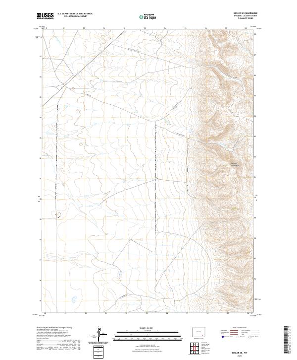
2021 Map of Bosler SE
USGS Topo · Published 2021About this map
The western slopes of the Laramie Mountains dominate the eastern reaches of this landscape, where steep topography transitions into a series of drainages and ranch corridors. The terrain is defined by the descent of Wallrock Cr and Gates Cr, which cut through the high country toward the basin floor. This area, largely organized by long-established section lines, reflects a classic Wyoming ranching layout where access is dictated by winding valley routes like Middle Creek Ranch Rd and Pascoe Ranch Rd. These roads often follow the natural contours of the land, tracing the paths of least resistance between the mountain ridges and the plains. The map's detail shows how water remains the primary driver of development in this arid environment, with labels such as Wall Canyon Rd and Wallrock Creek Rd indicating the vital relationship between the creek beds and the local transportation network.
Find a feature on this map
11 named features on this map. Tap any name to fly to it.
Don’t see what you’re looking for? This feature index may not catch every label — zoom into the map to look around manually.
Map Details
Editions of this 2021 Bosler SE Map
This is the sole edition of this map. No revisions or reprints were ever made.
Other maps of this area

1895 · Laramie
USGS Topo · 1:125,000

1902 · Laramie
USGS Topo · 1:125,000

1905 · Sherman
USGS Topo · 1:125,000

1905 · Laramie
USGS Topo · 1:125,000

1906 · Laramie
USGS Topo · 1:125,000

1908 · Laramie
USGS Topo · 1:125,000

1948 · Ragged Top Mountain
USGS Topo · 1:62,500

1950 · Ragged Top Mountain
USGS Topo · 1:62,500

1954 · Cheyenne
USGS Topo · 1:250,000

1955 · Bosler
USGS Topo · 1:24,000