
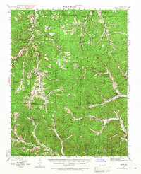
1943 Map of Boss
USGS Topo · Published 1963About this map
Clark National Forest encompasses the entirety of this mid-century landscape where the Ozark plateau is deeply incised by the headwaters of the Middle Fork Black River. The area is characterized by small, dispersed settlements like Viburnum and Boss, with social life centered around rural institutions such as Pleasant Grove Ch and Hickory Grove Ch. Numerous small schools, including Rocky Ford Sch and Bills Creek Sch, are scattered across the terrain, reflecting the era's localized educational structure before mid-century consolidation.
Find a feature on this map
90 named features on this map. Tap any name to fly to it.
Don’t see what you’re looking for? This feature index may not catch every label — zoom into the map to look around manually.
Map Details
Editions of this 1943 Boss Map
2 editions found
Other maps of this area

1906 · Potosi
USGS Topo · 1:62,500

1924 · Edgehill
USGS Topo · 1:62,500

1926 · Edgehill
USGS Topo · 1:62,500

1932 · Steelville
USGS Topo · 1:48,000

1933 · Steelville
USGS Topo · 1:62,500

1937 · Steelville
USGS Topo · 1:62,500

1941 · Stone Hill
USGS Topo · 1:62,500

1943 · Berryman
USGS Topo · 1:62,500

1943 · Lesterville
USGS Topo · 1:62,500

1944 · Corridon
USGS Topo · 1:62,500