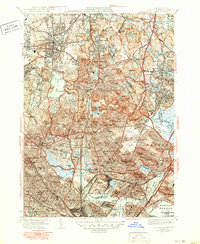
1946 Map of Boston North
USGS Topo · Published 1950About this map
The dense urban and suburban landscape north of Boston Harbor is captured here during the post-war industrial peak of the late 1940s. The region is defined by a heavy concentration of cemeteries and hospitals, such as the sprawling Woodlawn Cem and Holy Cross Cem, alongside vital regional infrastructure like Logan International Airport. The Boston and Maine RR network stitches together well-established towns from Malden and Everett to Melrose, while large tracts of open space like the Middlesex Fells Reservation and Stoneham Zoological Park provide a stark contrast to the surrounding grid-pattern neighborhoods.
Find a feature on this map
102 named features on this map. Tap any name to fly to it.
Don’t see what you’re looking for? This feature index may not catch every label — zoom into the map to look around manually.
Map Details
Editions of this 1946 Boston North Map
2 editions found
Other maps of this area

1886 · Lawrence
USGS Topo · 1:62,500

1888 · Lawrence
USGS Topo · 1:62,500

1888 · Salem
USGS Topo · 1:62,500

1892 · Boston Bay
USGS Topo · 1:62,500

1893 · Salem
USGS Topo · 1:62,500

1893 · Boston
USGS Topo · 1:62,500

1893 · Lawrence
USGS Topo · 1:62,500

1903 · Boston
USGS Topo · 1:62,500

1903 · Boston Bay
USGS Topo · 1:62,500

1917 · Salem
USGS Topo · 1:62,500