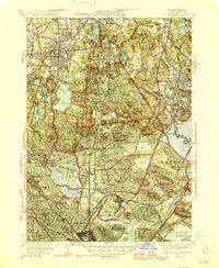
1946 Map of Boston North
USGS Topo · Published 1946About this map
Dense residential and industrial development dominates the northern Boston suburbs in the years following World War II, showing a landscape tightly integrated by the Boston and Maine RR. The massive Middlesex Fells Reservation provides a significant green space, anchoring the region with Spot Pond and the Zoological Park. Along the southern edge, the industrial activity of Mystic Wharf and the US Naval Reservation highlights the area's maritime importance near Boston Harbor.
Find a feature on this map
115 named features on this map. Tap any name to fly to it.
Don’t see what you’re looking for? This feature index may not catch every label — zoom into the map to look around manually.
Map Details
Editions of this 1946 Boston North Map
2 editions found
Other maps of this area

1886 · Lawrence
USGS Topo · 1:62,500

1888 · Lawrence
USGS Topo · 1:62,500

1888 · Salem
USGS Topo · 1:62,500

1892 · Boston Bay
USGS Topo · 1:62,500

1893 · Salem
USGS Topo · 1:62,500

1893 · Boston
USGS Topo · 1:62,500

1893 · Lawrence
USGS Topo · 1:62,500

1903 · Boston
USGS Topo · 1:62,500

1903 · Boston Bay
USGS Topo · 1:62,500

1917 · Salem
USGS Topo · 1:62,500