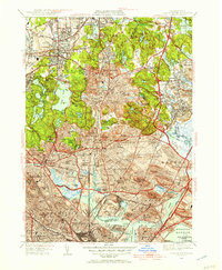
1949 Map of Boston North
USGS Topo · Published 1957About this map
Middlesex Fells Reservation dominates the center of this landscape, a preserved wilderness of rugged outcroppings like Eagle Rock and Black Rock surrounding the waters of Spot Pond. To the south and east, the dense urban corridors of Melrose, Malden, and Everett are tightly mapped, showing the intricate street grids and the sprawling infrastructure of the B and M RR. The map captures a moment when industrial and residential development pressed right against the tidal marshes of the Saugus River and the Pines River, where the Seaplane Basin and early runways of what would become a major airport sit along the Boston Harbor coast.
Find a feature on this map
122 named features on this map. Tap any name to fly to it.
Don’t see what you’re looking for? This feature index may not catch every label — zoom into the map to look around manually.
Map Details
Editions of this 1949 Boston North Map
This is the sole edition of this map. No revisions or reprints were ever made.
Other maps of this area

1886 · Lawrence
USGS Topo · 1:62,500

1888 · Lawrence
USGS Topo · 1:62,500

1888 · Salem
USGS Topo · 1:62,500

1892 · Boston Bay
USGS Topo · 1:62,500

1893 · Salem
USGS Topo · 1:62,500

1893 · Boston
USGS Topo · 1:62,500

1893 · Lawrence
USGS Topo · 1:62,500

1903 · Boston
USGS Topo · 1:62,500

1903 · Boston Bay
USGS Topo · 1:62,500

1917 · Salem
USGS Topo · 1:62,500