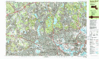
1985 Map of Boston North
USGS Topo · Published 1986About this map
The Mystic River and its associated lakes anchor this mid-1980s look at the densely developed suburbs north of the Charles. Following a period of significant regional infrastructure growth, the map shows the complex network of parkways like Fellsway East and major thoroughfares such as the Yankee Division Highway carving through established neighborhoods. While much of the area is urbanized, the sprawling Middlesex Fells Reservation remains a significant green space, dotted with reservoirs and rocky summits like Boojum Rock. The presence of major institutions, including Tufts University and Harvard University, alongside the industrial and transit hubs of Everett and Chelsea, illustrates the diverse economic character of the region. Local history is preserved in the detailed mapping of numerous cemeteries such as Woodlawn Cemetery and landmark structures like the Bunker Hill Monument in Charlestown.
Find a feature on this map
157 named features on this map. Tap any name to fly to it.
Don’t see what you’re looking for? This feature index may not catch every label — zoom into the map to look around manually.
Map Details
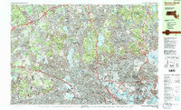
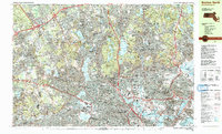
Editions of this 1985 Boston North Map
3 editions found
Other maps of this area

1886 · Lawrence
USGS Topo · 1:62,500

1886 · Lowell
USGS Topo · 1:62,500

1886 · Framingham
USGS Topo · 1:62,500

1888 · Lawrence
USGS Topo · 1:62,500

1888 · Salem
USGS Topo · 1:62,500

1889 · Framingham
USGS Topo · 1:62,500

1892 · Boston Bay
USGS Topo · 1:62,500

1893 · Lowell
USGS Topo · 1:62,500

1893 · Salem
USGS Topo · 1:62,500

1893 · Boston
USGS Topo · 1:62,500