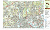
1985 Map of Boston North
USGS Topo · Published 1986About this map
The Mystic River serves as a central artery through this densely developed corridor north of the Charles, winding from Upper Mystic Lake past Medford and Somerville toward the Inner Harbor. The landscape is a complex mix of urban infrastructure and significant preserved spaces, anchored by the expansive Middlesex Fells Reservation and the Breakheart Reservation further northeast. Academic institutions form major landmarks, with the sprawling grounds of Harvard University and Tufts University clearly delineated alongside historic commemorative sites like the Bunker Hill Mon in Charlestown.
Find a feature on this map
194 named features on this map. Tap any name to fly to it.
Don’t see what you’re looking for? This feature index may not catch every label — zoom into the map to look around manually.
Map Details
Editions of this 1985 Boston North Map
3 editions found
Other maps of this area

1886 · Lawrence
USGS Topo · 1:62,500

1886 · Lowell
USGS Topo · 1:62,500

1886 · Framingham
USGS Topo · 1:62,500

1888 · Lawrence
USGS Topo · 1:62,500

1888 · Salem
USGS Topo · 1:62,500

1889 · Framingham
USGS Topo · 1:62,500

1892 · Boston Bay
USGS Topo · 1:62,500

1893 · Lowell
USGS Topo · 1:62,500

1893 · Salem
USGS Topo · 1:62,500

1893 · Boston
USGS Topo · 1:62,500