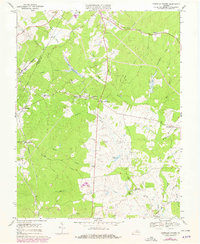
1970 Map of Boswells Tavern
USGS Topo · Published 1978About this map
The South Anna River and its numerous tributaries, including Happy Creek and Lickinghole Creek, define the landscape of this region during the 1970s. The settlement pattern follows the historic Chesapeake and Ohio railroad line, which connects rural hubs like Lindsay, Waldrop, and the namesake Boswells Tavern. This area of Virginia is characterized by a high density of rural community centers, represented by numerous country houses of worship such as Pleasant Plain Ch, Wills Memorial Ch, and St Johns Chapel.
Find a feature on this map
47 named features on this map. Tap any name to fly to it.
Don’t see what you’re looking for? This feature index may not catch every label — zoom into the map to look around manually.
Map Details
Editions of this 1970 Boswells Tavern Map
4 editions found
Other maps of this area

1891 · Palmyra
USGS Topo · 1:125,000

1892 · Gordonsville
USGS Topo · 1:125,000

1895 · Palmyra
USGS Topo · 1:125,000

1897 · Palmyra
USGS Topo · 1:125,000

1935 · Charlottesville
USGS Topo · 1:62,500

1939 · Charlottesville
USGS Topo · 1:62,500

1943 · Scottsville
USGS Topo · 1:62,500

1946 · Scottsville
USGS Topo · 1:62,500

1947 · Roanoke
USGS Topo · 1:250,000

1949 · Charlottesville
USGS Topo · 1:250,000