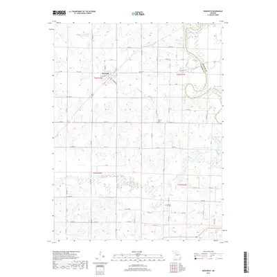
2017 Map of Bosworth
USGS Topo · Published 2017About this map
Bosworth serves as the primary hub of this north-central Missouri landscape, situated near the intersection of State Hwy M and State Hwy UU. The surrounding countryside is defined by an intricate network of waterways, including the winding Grand River and numerous tributaries such as Snow Br and Big Cr that drain the agricultural sections. Genealogical interest is centered on several established burial grounds, including Wharton Cem, Union Cem, and Pleasant Park Cem, which provide historical anchors for local families. The eastern boundary is marked by the Carroll Co Chariton Co line, where the terrain shifts toward the river bottomlands near Potter Slough and Grace Lake. This survey illustrates the persistent rural grid of county roads, like Co Rd 321 and Co Rd 351, that connect these isolated farmsteads and cemeteries across the townships.
Find a feature on this map
71 named features on this map. Tap any name to fly to it.
Don’t see what you’re looking for? This feature index may not catch every label — zoom into the map to look around manually.
Map Details
Editions of this 2017 Bosworth Map
This is the sole edition of this map. No revisions or reprints were ever made.
Other maps of this area

1890 · Marshall
USGS Topo · 1:125,000

1892 · Marshall
USGS Topo · 1:125,000

1901 · Marshall
USGS Topo · 1:125,000

1924 · Hale
USGS Topo · 1:62,500

1949 · Mendon
USGS Topo · 1:24,000

1950 · Hale
USGS Topo · 1:24,000

1951 · Hale
USGS Topo · 1:24,000

1951 · Bosworth
USGS Topo · 1:24,000

1951 · Miami
USGS Topo · 1:24,000

1951 · Brunswick West
USGS Topo · 1:24,000