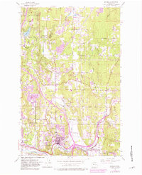
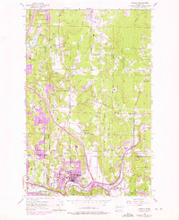
1953 Map of Bothell
USGS Topo · Published 1981About this map
The Sammamish River serves as the focal point for this landscape, flowing through the valley where Bothell, Kenmore, and Woodinville meet. Based on 1950s data with later revisions, the map highlights the transition from rural industry to suburban expansion, evidenced by the purple-tinted urban extensions around family-named landmarks like Wintermutes Corner and Thrashers Corner. The proximity of the Burlington Northern line to local industry is clear near the Bloomberg Mill, while the Martha Lake Airport to the north reflects the region's mid-century infrastructure. This area at the border of Snohomish and King counties shows a intricate network of drainage, where North Creek and Swamp Creek flow south toward the river, carving through terrain like Norway Hill and Canyon Park.
Find a feature on this map
31 named features on this map. Tap any name to fly to it.
Don’t see what you’re looking for? This feature index may not catch every label — zoom into the map to look around manually.
Map Details
Editions of this 1953 Bothell Map
5 editions found
Other maps of this area

1894 · Seattle
USGS Topo · 1:62,500

1895 · Snohomish
USGS Topo · 1:125,000

1897 · Seattle
USGS Topo · 1:125,000

1908 · Seattle
USGS Topo · 1:62,500

1909 · Seattle Special
USGS Topo · 1:62,500

1942 · Edmonds
USGS Topo · 1:62,500

1944 · Everett
USGS Topo · 1:62,500

1949 · Seattle North
USGS Topo · 1:24,000

1950 · Redmond
USGS Topo · 1:24,000

1950 · Kirkland
USGS Topo · 1:24,000